Septic Elevation Tool 
The elevation tool is a multipurpose tool used for declaring spot elevations, pipe invert measurements, discharge points
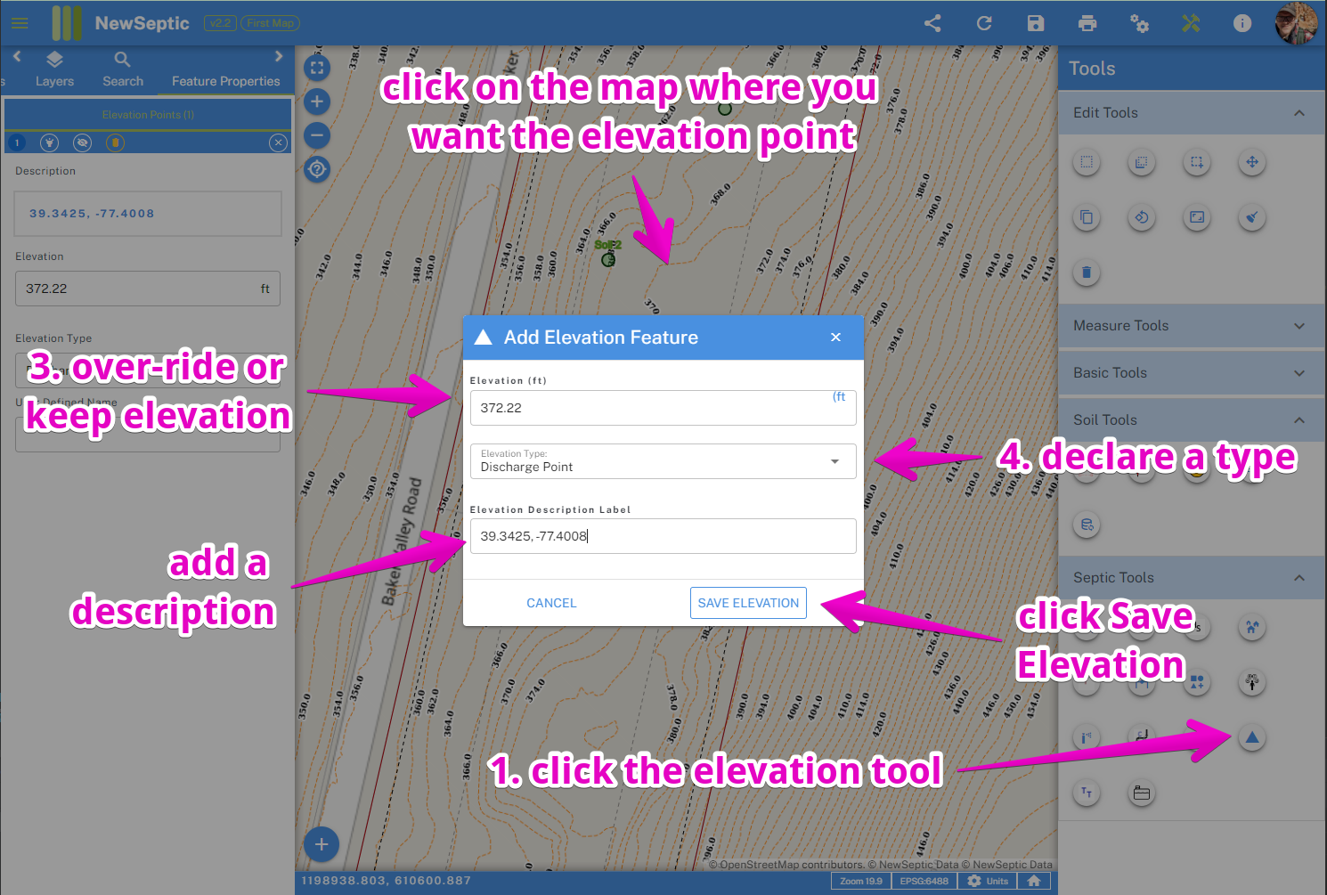
To start using the tool, you can follow these steps:
Locate and click on the septic elevation tool icon. The septic elevation tool is located on the right tool panel located here:
Click on the map you would like to add the point. If connecting to existing drawn features like a pipe we recommend to ensure snapping is turned on for the feature you would like to connect to. You can learn more about the snapping concept and how it's handled in landplan.io at: Snapping Concepts
Select the type of point you would like to add to your map. The different Here is an explanation of the pipe types:
- Benchmark = the location point on the map which can be marked onsite and serves as a reference point for measurements
- Discharge Point = the location on the map where a discharge point is located
- Pipe Invert = a measurement of an elevation point in a pipe line
- Spot Elevation = a general elevation point on the map
- Pipe Cleanout = a point on a pipe line which will have a clean out installed to grade
- Pipe Fitting = a point on a pipe line which a fitting will be used system
These types are important, because if using the reporting mechanism, these can be used to understand the system type and important elevations.
- The elevation provided represents the best available elevation from our digital elevation model services used. It should provide a good estimation of elevation at that point until more accurate measurements can be made onsite. One goal of our software is to provide a good first initial plan before heading out to any site, in order to optimize your time onsite and determining a general layout plan. You can learn more here: elevation process and hierarchy of accuracy
WARNING
Depending on the accuracy required, the elevation may not suite your requirements, and we cannot give an accuracy statement at this time. You always have the ability to override this value with you own more accurate value.
You can optionally provide a description of the elevation measurement in the description input.
Click Save Elevation to add the point or Cancel to exit out of the tool window