Start Here
You've signed up and aren't sure what to do first? Here is a step-by-step guide on how to use landplan.io effectively
Start a New Project
First, thank you for signing up. We appreciate every new customer we get. landplan.io is a project based software. Everything is focused on helping you manage a "Project", which we define as a piece of land you would like to plan some work on.
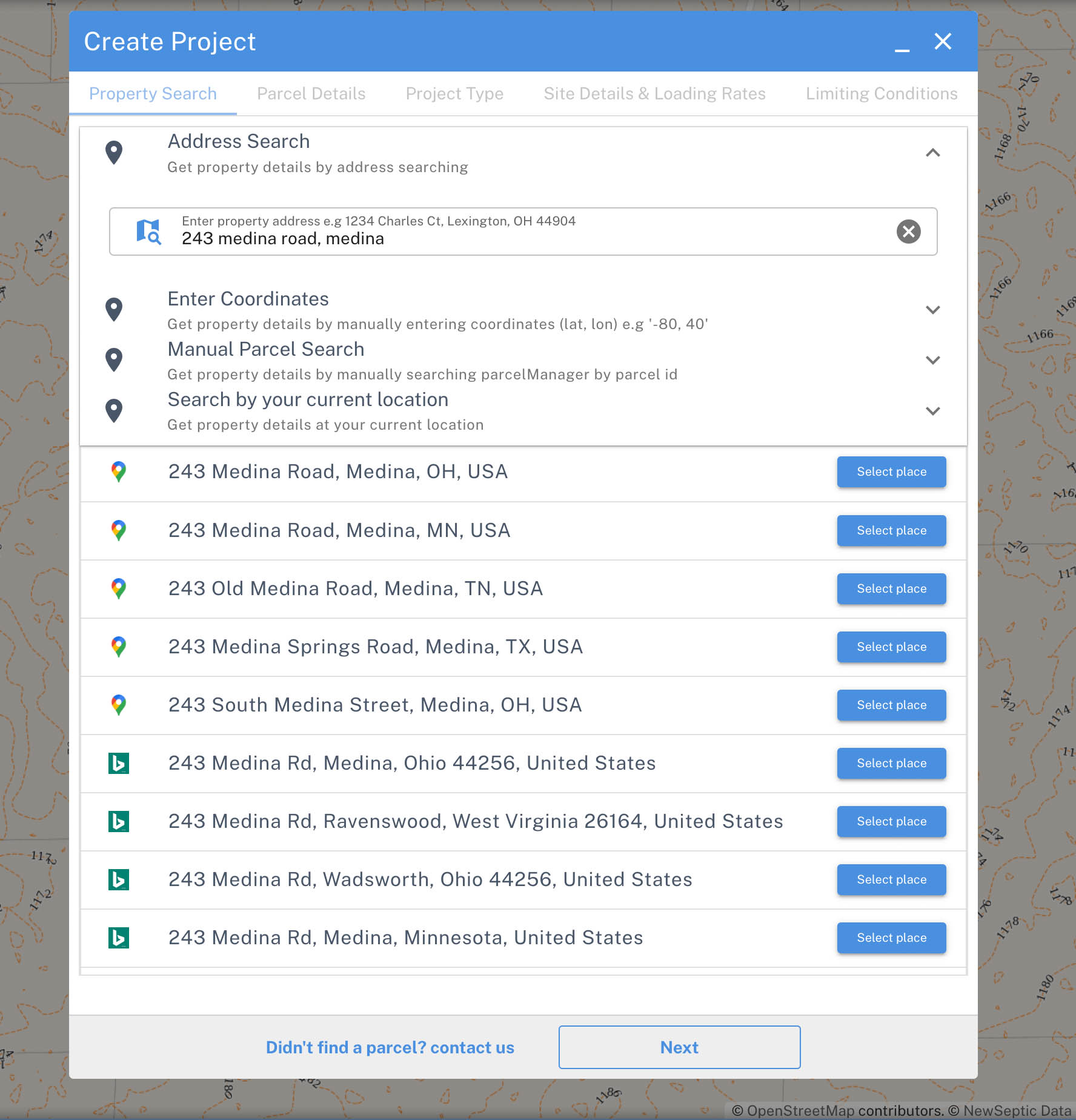
Searching for a Property
We offer 2 separate ways to start a new project. A project may consist of one or more maps and design plans.
Map Search
This is the preferred method to start a project as we can at least help fill in some minor details about the project, for example, the project's state, county, and township. Almost every project will be formed from one or more parcels of land.
We offer a parcel search feature that isn't limited to one county. Search by address or latitude and longitude or a point, and we find the jurisdiction and any parcel of land at that location.
Situational Awareness
If you find a parcel, we offer all information available for this property, including geographic information (parcel lines, sewer and water lines, 2 ft. contour intervals, water features, aerial photos, feature buffers, etc.).
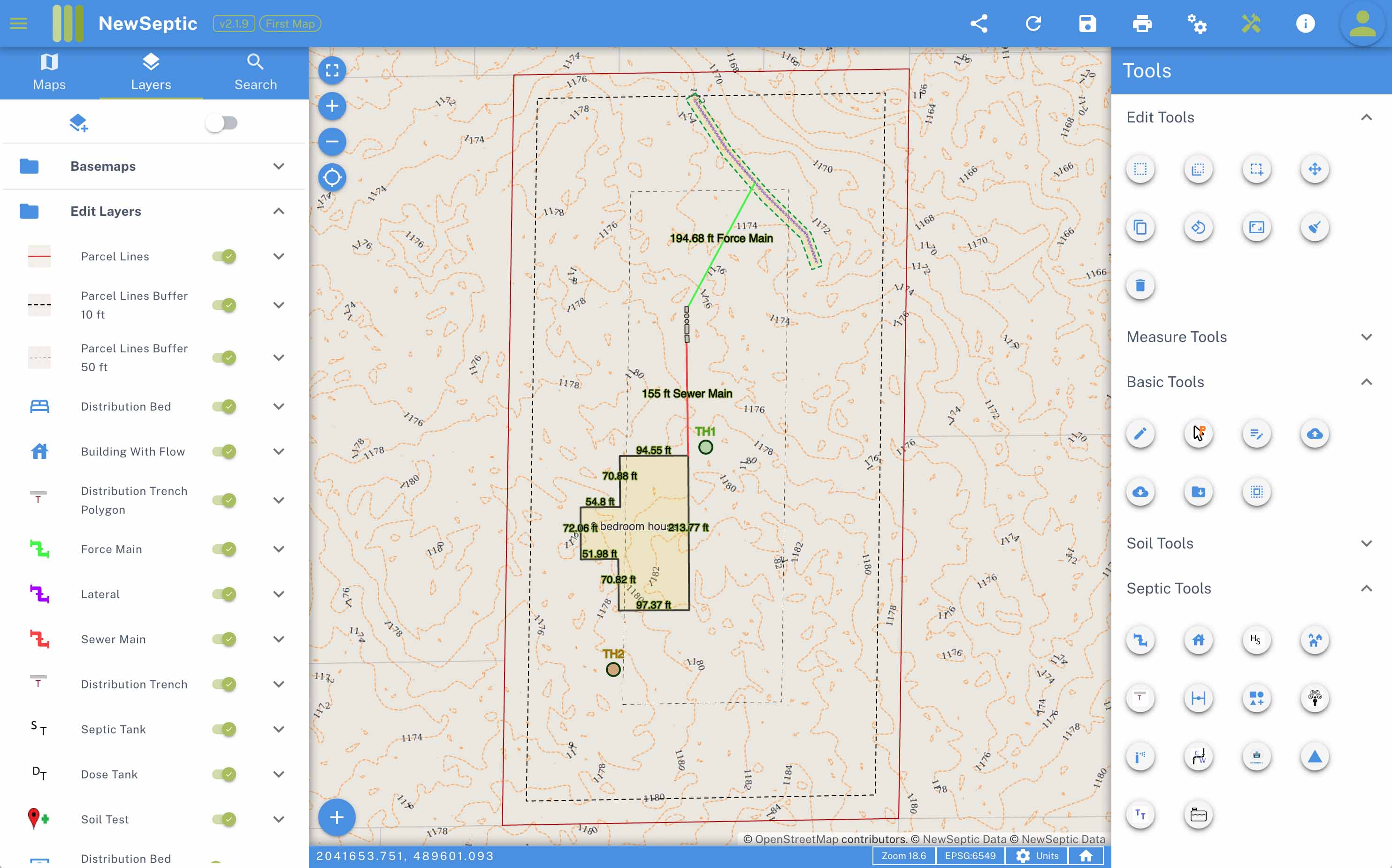
Use our septic planning tools to draw any component required for a functioning onsite wastewater treatment system. Our tools are designed to be simple to use and created by septic designers to save you time. We know that planning a septic layout is time-consuming when done properly.
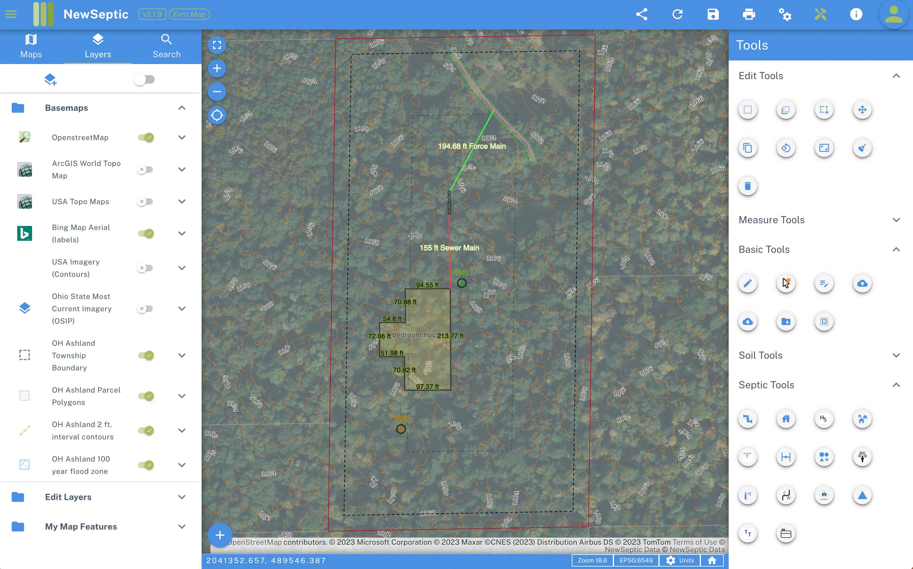
Not Overly Complicated Mapping
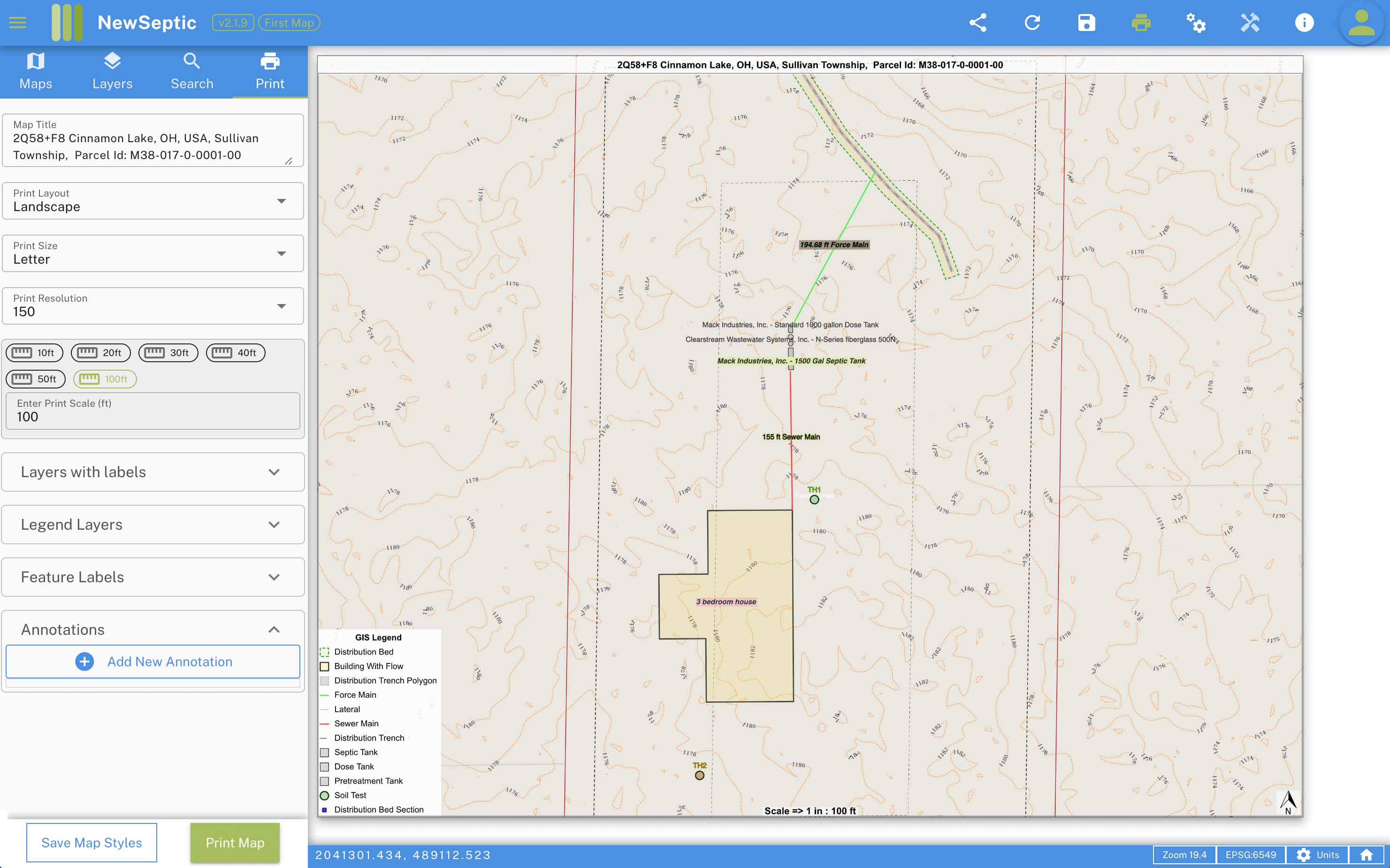
We've designed our web mapping solution with a couple of points in mind. One is we want to provide geographic information from our database. You don't have to go out and find data to start a map. Two is we didn't want you to have to worry about styling lines, tracking layers you've drawn, and labeling.
We handle all the styling and labeling for your map. We wanted to make putting the finishing touches on your map simple with an easy to use print menu. No overly complicated CAD training or licensing. Our web map provides you with the data you need for your project and a simple manageable workflow to add features to your map and print.
From Your Map Get Estimates
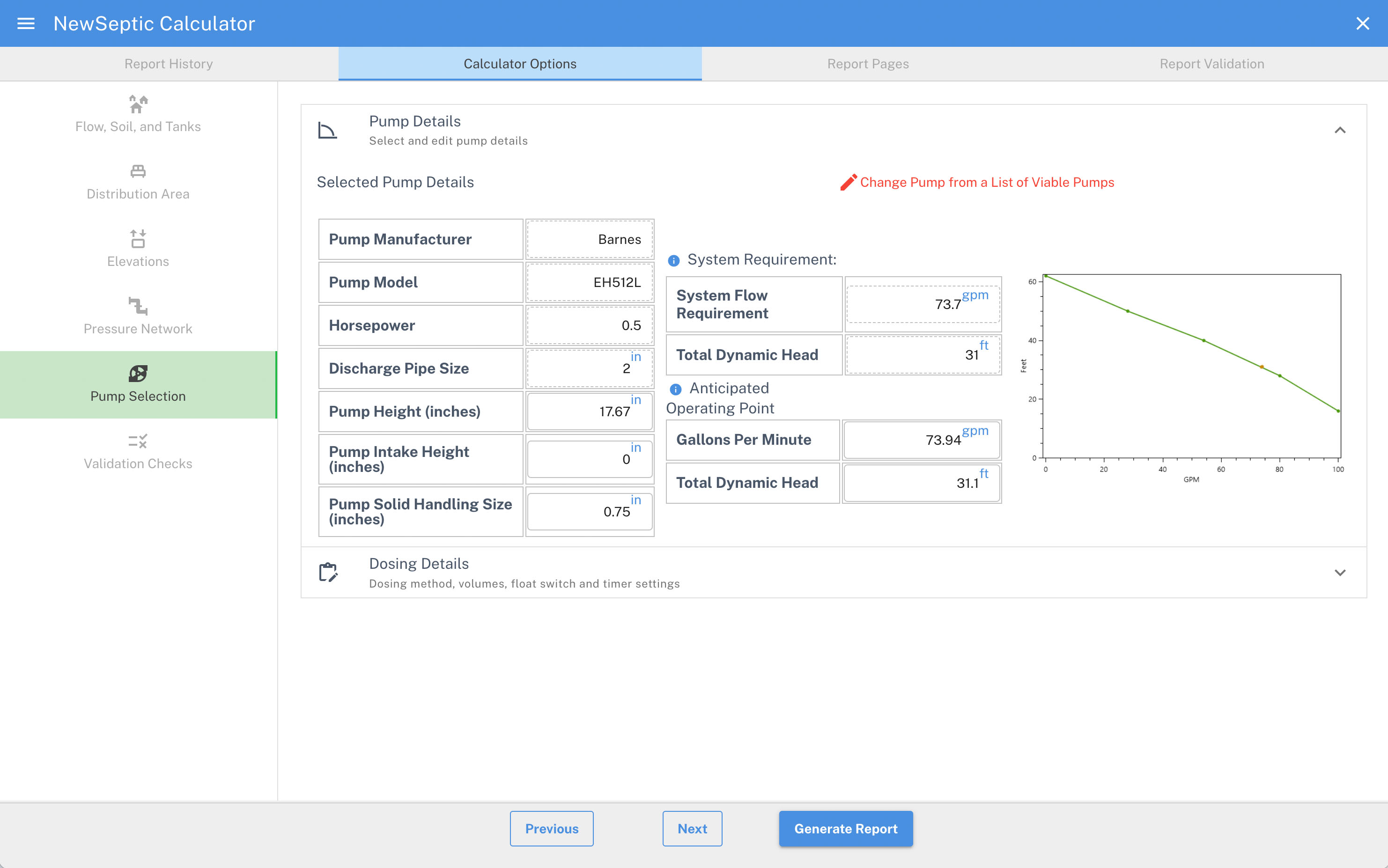
We track and store every feature your draw on the map. You can use our Generate design button to take your drawn features (pipes, tanks, and soil absorption components) to generate Materials Estimates, Construction Notes, Pressure Network and Dosing Details, Pump Selection, Product Spec Sheet Links, Calculation Sheet.
Smart Workflow
We know that a map of a septic system layout may not be everything you need to submit for approvals. The local regulator may also need to view additional information.
You can transfer the components you've drawn on the map into one of our calculators to further refine your plan including changing lateral and pressure network configurations and final pump selection.
When you are satisfied with your plan, you can download a pdf copy.
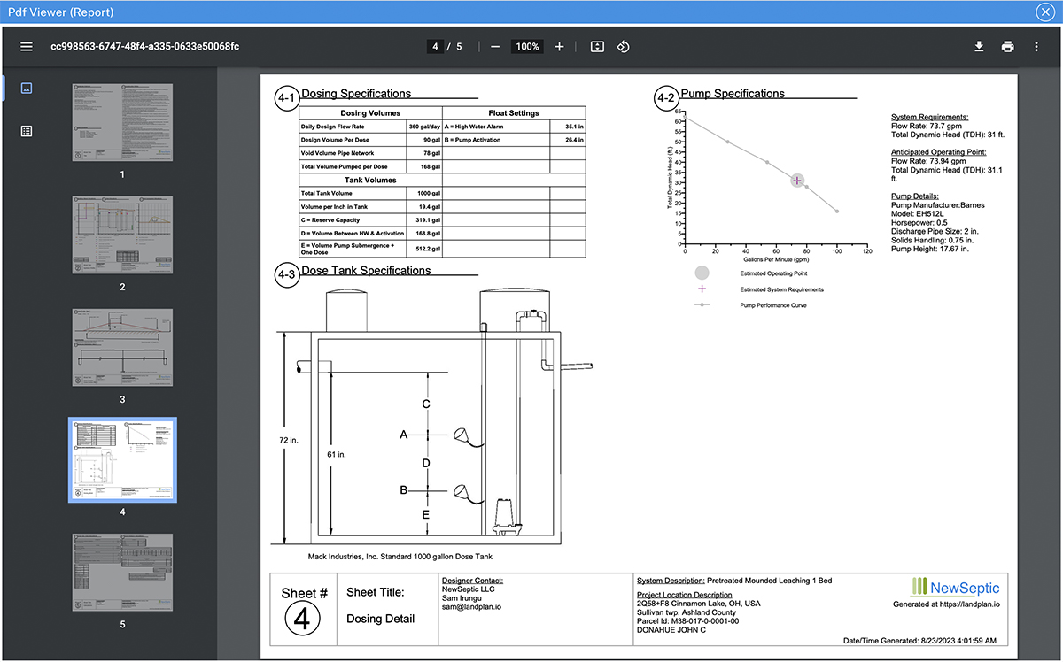
Changes you make on your plan are saved and, we provide a version system for each plan you generate. That means if you need to make a change to a plan, simply log in from any computer and update your plan, print a new version of that plan. A unique Datetime stamp is shown in the bottom, so all parties know which version is most current.
Project Management
Onsite wastewater treatment planning is pretty complicated. You need to try and find a solution for a property quickly before you possibly lose the job to a competitor.
Most often, you will get only pieces of the information you need to complete a proper assessment of a project.
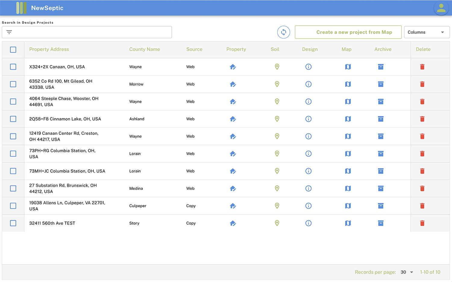
Start a project and fill in details as they come in. Archive old jobs, prioritize your work, collaborate with your team with our online project management menu. Get monthly diagnostics on your work.
More
Check out the YouTube video with a general walkthrough on the design process using landplan.io.