
Project information
The App & Project Information window gathers the facts of the open project, ready to copy into an email or a form, with links to the county's own sites and the facts of the parcel. It also shows which version of landplan.io you are using.
Open Project information
With a project's map open, click ⋮ (More actions) at the right of the toolbar and choose Project information. You can also press Ctrl+F (⌘+F on a Mac) on the map.
On a shared map, click the i (Project information) at the top.
The window has two tabs, App Information and Project Information. It opens on Project Information. Close it with the ×.
The Project Information tab
The Project Information tab lists the facts of the project and its map.
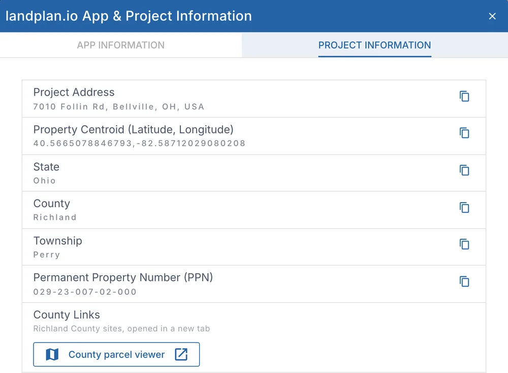
| Fact | What it is |
|---|---|
| Project Address | The property's address. |
| Project Owner Name | The landowner, when the project has one. |
| Property Area (Acres) | The parcel's area, when known. |
| Property Centroid (Latitude, Longitude) | The centre of the property. |
| State, County and Township | Where the property is. |
| Permanent Property Number (PPN) | The parcel number. |
| County Links | The county's own sites. See County links. |
| Parcel Facts | What our parcel data holds for the parcel. See Parcel facts. |
| Current Map on View and Current Map Version | The map you are on, and its saved version. |
| Preferred Map Projection | The projection the map uses, for example EPSG:6549. |
| Project Id | The project's id, for support. |
Click the copy button next to a fact to copy it to the clipboard.
With no project open, the tab says No project loaded in the current map, with Create a project.
County links
When we have them for the project's county, County Links opens the county's own sites in a new tab:
- County parcel viewer: the county's parcel map, to compare the parcel lines with the county's latest records.
- County auditor / property record: the auditor's record of the property, such as the building, bedrooms and square footage.
Where the county's site takes a parcel number, the link opens at the project's PPN. Otherwise it opens the county's search page: copy the PPN from the window and paste it there.
Parcel facts
Parcel Facts lists what our parcel data holds for the project's parcel:
- Number of Dwellings and Number of Bedrooms.
- Property Zoning, Land Use and Year Built.
- Deeded Area (Acres) and GIS Area (Acres).
- Owner of Record and Last Sale Date.
- When the county's data has them: Building Area (sq ft), Bathrooms, Stories, Owner Occupied, Assessed Value and Assessed Year.
Under the list are the source (the county data set, linked to its page when it has one), when we last loaded the county's data, when the parcel's record changed, and when you looked.
We never fill in a value we don't have:
- Not available for this county: the county's data doesn't include that fact. Zoning, for example, isn't in any county's parcel data yet.
- Not recorded for this parcel: the county's data has the fact, but not for this parcel.
County records are often newer than ours. Check the county auditor's property record (see County links) before you rely on a fact such as the number of bedrooms.
Value, tax & sales
When the county's records include them, a Value, tax & sales group follows the facts: Total value (with its kind and year, for example Assessed 2026), Land / Improvements, Annual tax, Homestead, Last sale, Property class / land use, Subdivision and Legal description (tap More for a long one). Sales history opens a list of up to 10 recorded sales, newest first. Amounts are in US dollars, or Canadian dollars for a project in a province. Only what the records hold is listed, and the group doesn't show when they hold none.
These figures are for reference only: they come from county records, with the date they are from, and are not an appraisal.
When the facts can't be read, a line says why, for example The parcel data service could not be reached. Try again later. The facts the map's parcel lines carry show instead, when there are some.
The App Information tab
The App Information tab shows the version of landplan.io you are using.
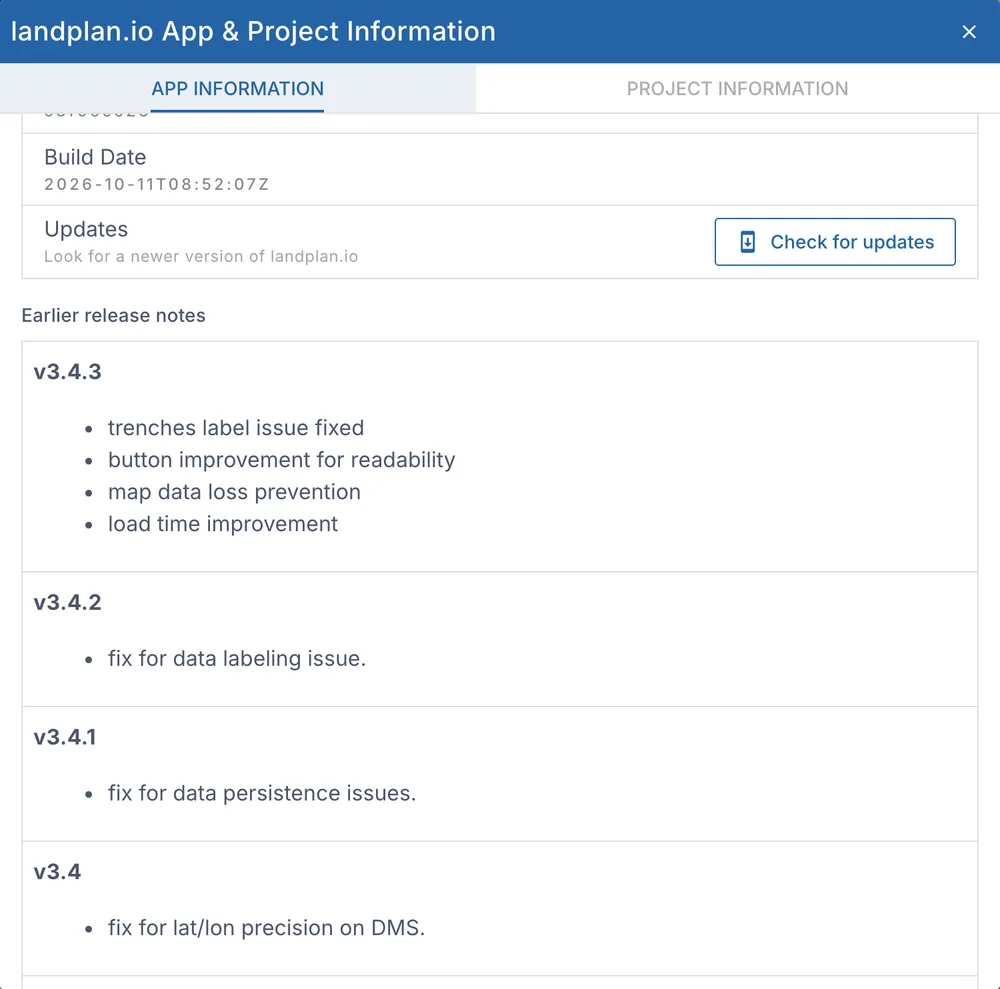
- App Version, Commit and Build Date. Click the copy button next to the version to copy its details, for example to send them to support.
- Updates: click Check for updates to look for a newer version. When there is one, a window says A new version of landplan.io is ready: click Update now.
- Earlier release notes: what changed in earlier versions.
You can also click the version number next to the logo on the map toolbar to see the version and check for updates.