Map Layers
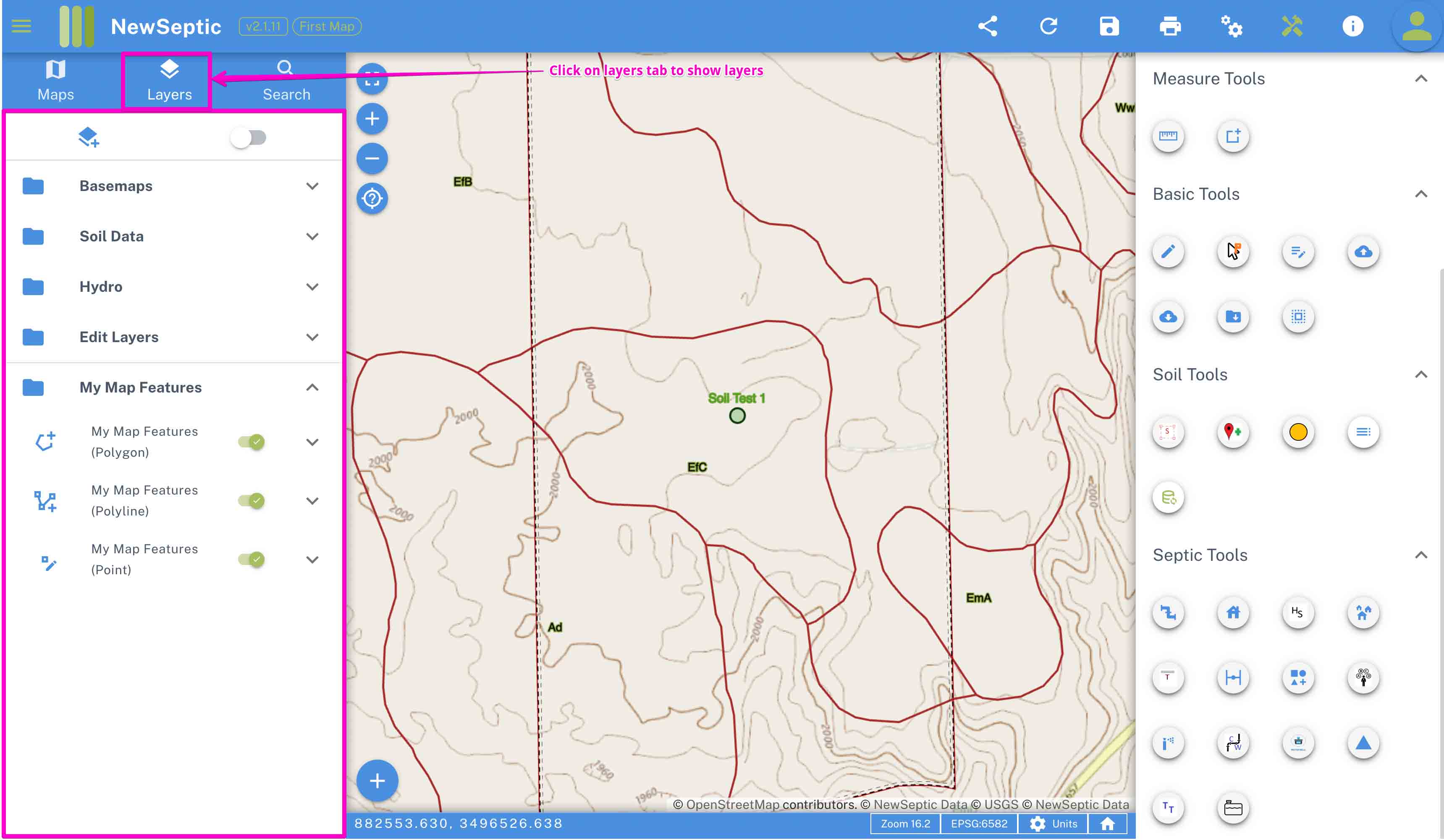
The left drawer on the mapping app contains several tabs and one of the main tab is the map layers tab. The map layers component allow users to interact with the default layers, add more layers and easily group layers for better management.
Layer Context Menu
With a right-click on the mouse (on touch screen use long press) on any layer, you get access to a context menu (dialog) with options for the specific layer. The options are populated dynamically based on the specific layer and the menu differs from one layer to another.
Below is a sample of this (based on :
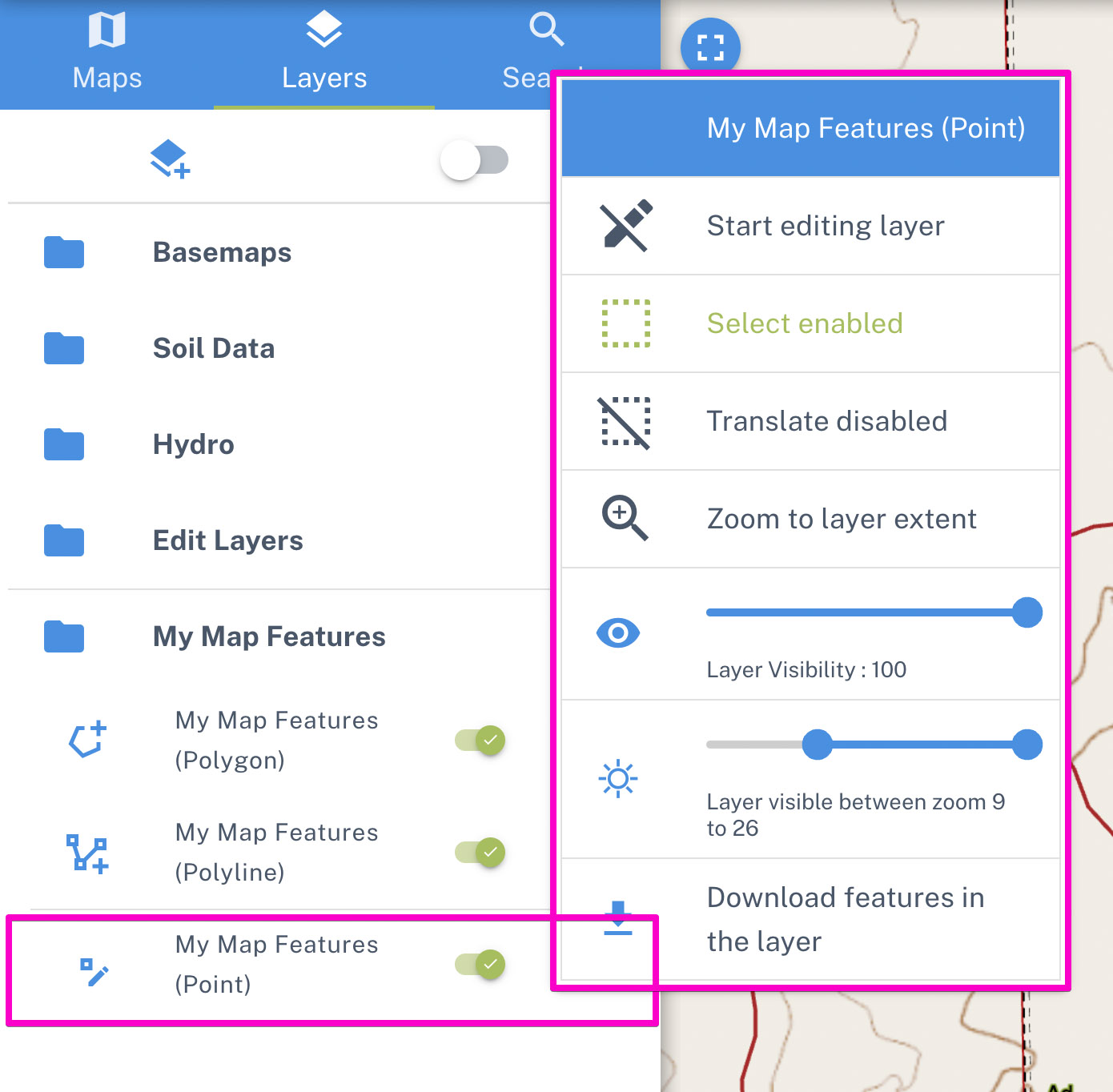
Some of the key functionalities in the layer context menu include the following:
- Start editing - if the type of layer allows editing, this tool with activate the tool to be edited
- Select - you can enable a layer to be selectable or not by toggling on this tool
- Translate - you can enable or disable translate (moving) of features in the current layer
- Zoom to extent - for vector layers with several features, the tool zooms to the extent of features in this layer
- Layer visibility - you can adjust the layer visibility on the map with this tool. This applies to all layers
- Layer zoom levels - set the zoom levels at which this layer can be seen on the map
- Download features - for vector layers, some layers are set to allow exporting features and downloading them
- Clear layers features - some editable layers allow deleting all their features. (This is to be done with caution)
- Refresh layer - for server layers, we can use this tool to clear and reload new tiles or features
- Remove layer from map - some of the added layers can be removed from map
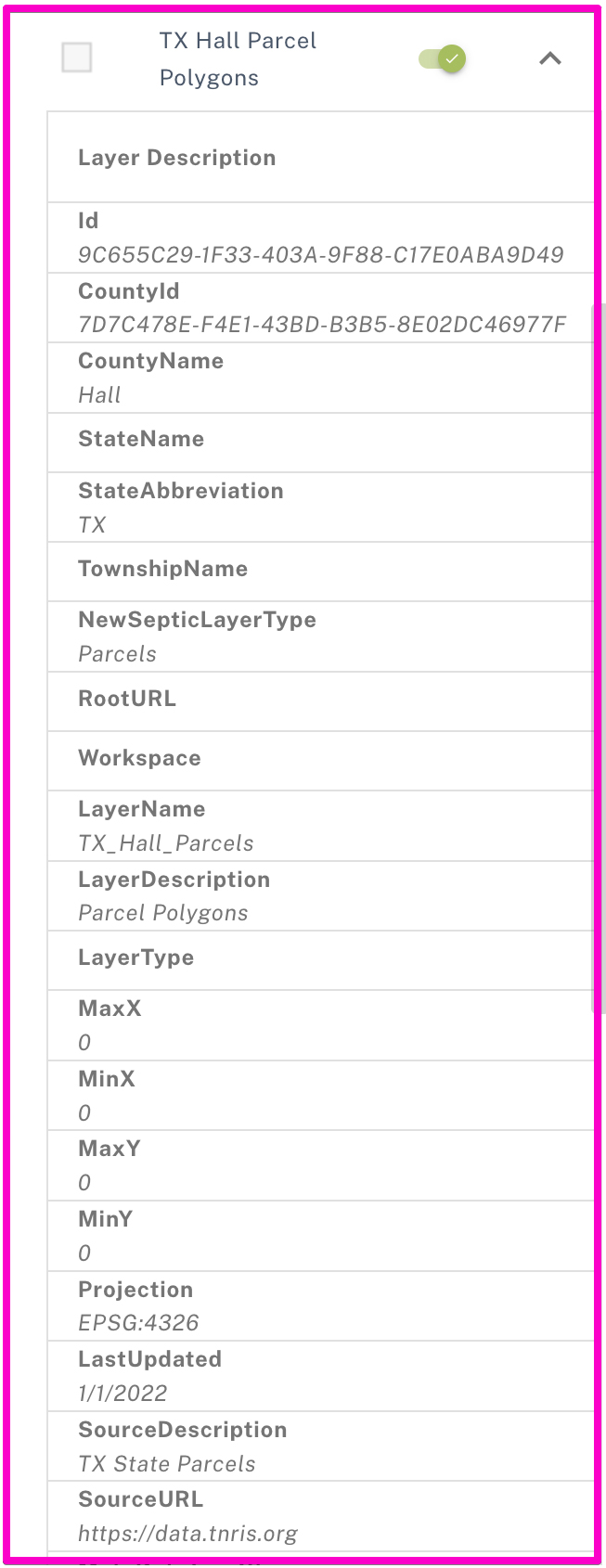
Layer Description
On expanding the expansion item of a layer, you can find some metadata about the specific layer. This is common for server layers (layers served from our servers such as contours and parcel data). This may be helpful to gather information such as when the data was created and source of the data.
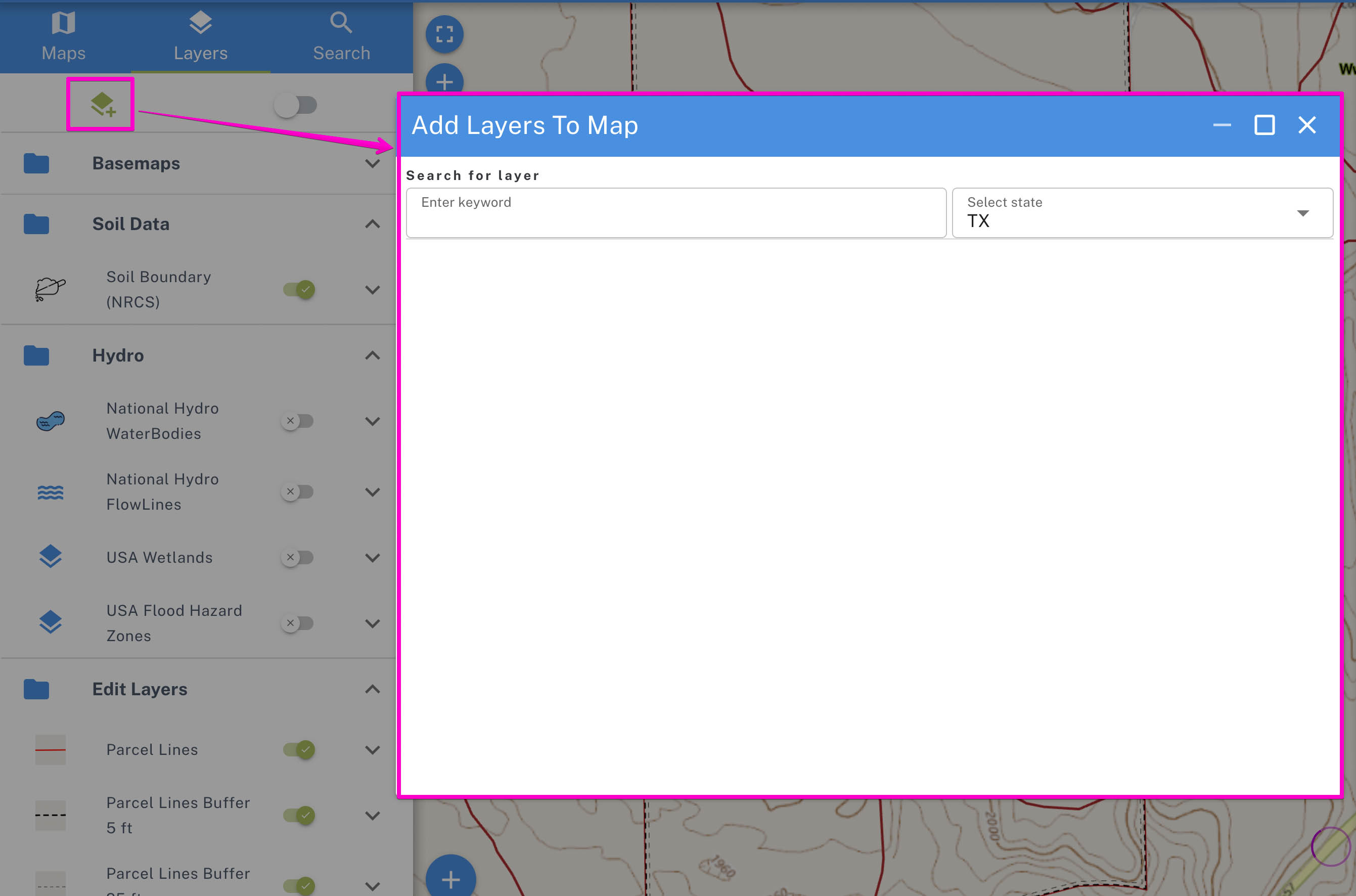
Add Layer To Map
You can search for a layer in our catalog and add to your current map. NewSeptic servers host several thousands of data ranging from contours, water lines, sewer lines, wetlands, DEMs, aerial imagery etc.
The data in these layers can help in decision-making on right place to place your septic system as well as improve your printed map
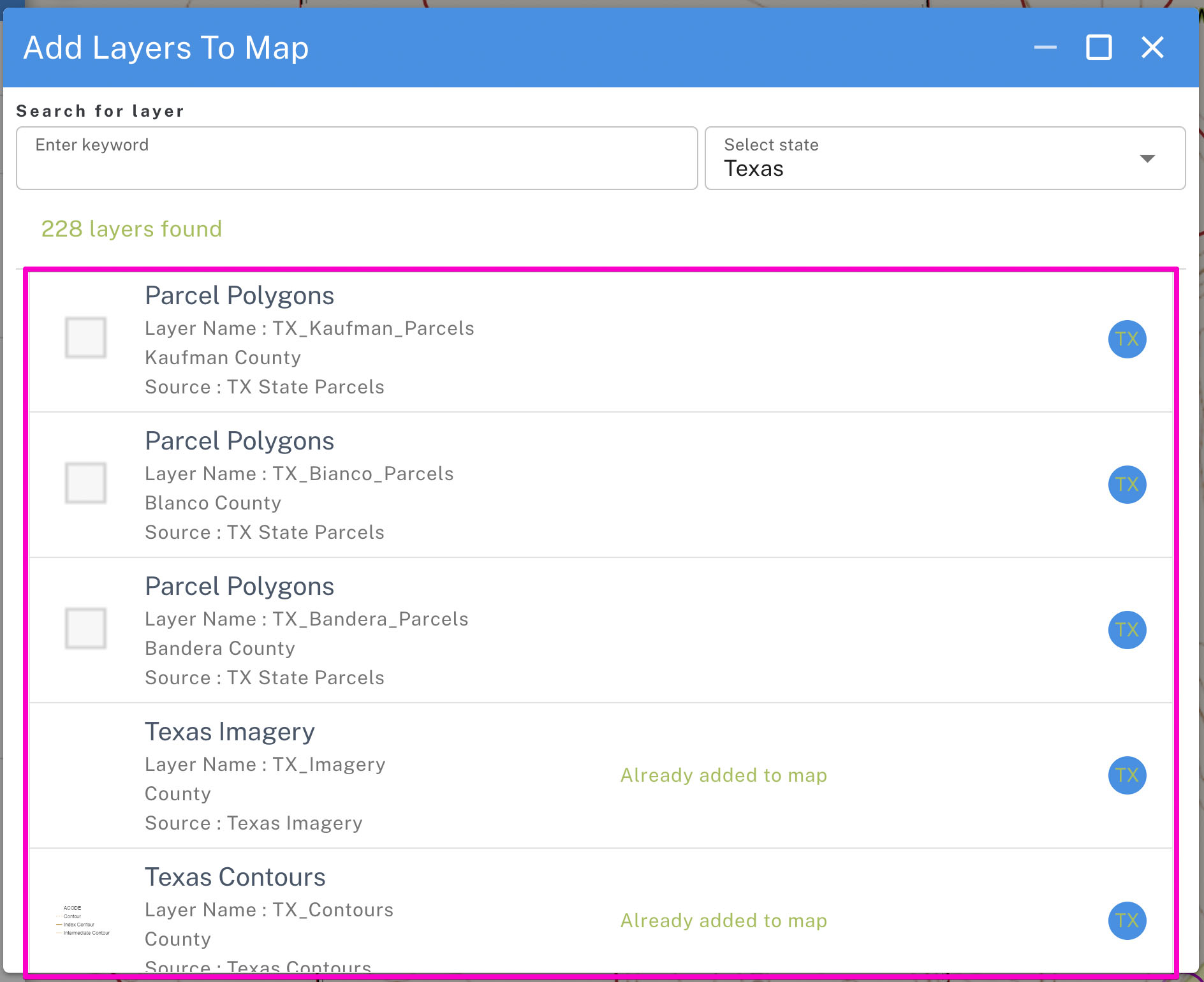
Sample of a filter in Texas State, USA:
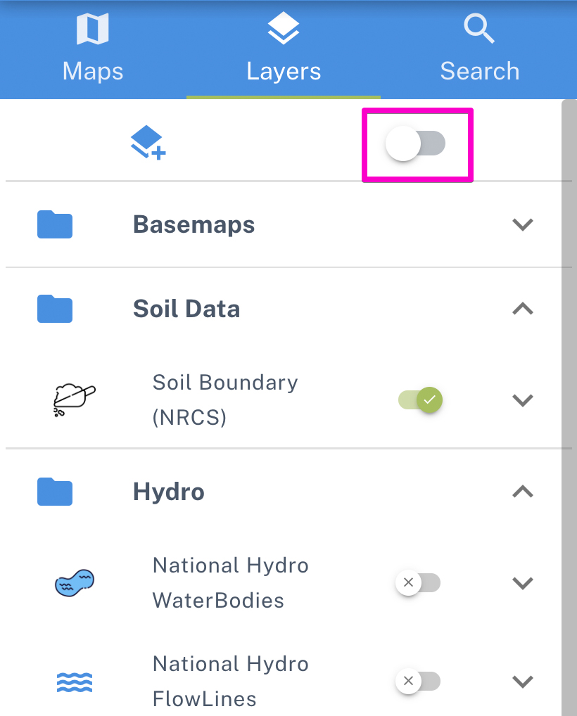
Show All Layers
The tool allows to show all layers, as some of the layers run in background and are less used. In special cases you may need to interact with such layers and this tool exposes these layers. The tool can also be used to hide the less used layers in case the layers were initially activated.