Export GPS Coordinates
Exporting coordinates is an important step to transitioning between the desktop analysis and field measurements.
Follow the steps below to export your drawn component vertex points:
- In the Basic Toolset, find the Export GPS points tool and click it
- Select the format you would like to export the drawn features to **
- Select the "Coordinate Reference System" (CRS) of the points you wish to export. landplan typically only offers 2 CRS types, World projection or State Plane If you have latitude and longitude coordinates, then you CRS is WGS84 or a World CRS.
- Select all drawn components you would like to export
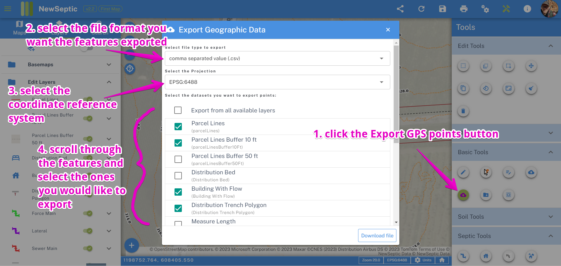
** comma separated value .csv file format landplan makes exporting the vertices of your drawn components into single and well-named GPS points simple. To get started, you will need to simply determine which components vertex points you would like to export:
landplan will export the points into the following structure:
Name Latitude or Northing Longitude or Easting Elevation
If you have never worked with CSV files, these files are text files with the file suffix .csv and have rows of data, with each row having columns of data separated by comma.
shapefile .shp format landplan will create a compressed file of individual shapefiles for each feature selected. the feature will have geometry based on its drawn geometry (polygon, line, point)