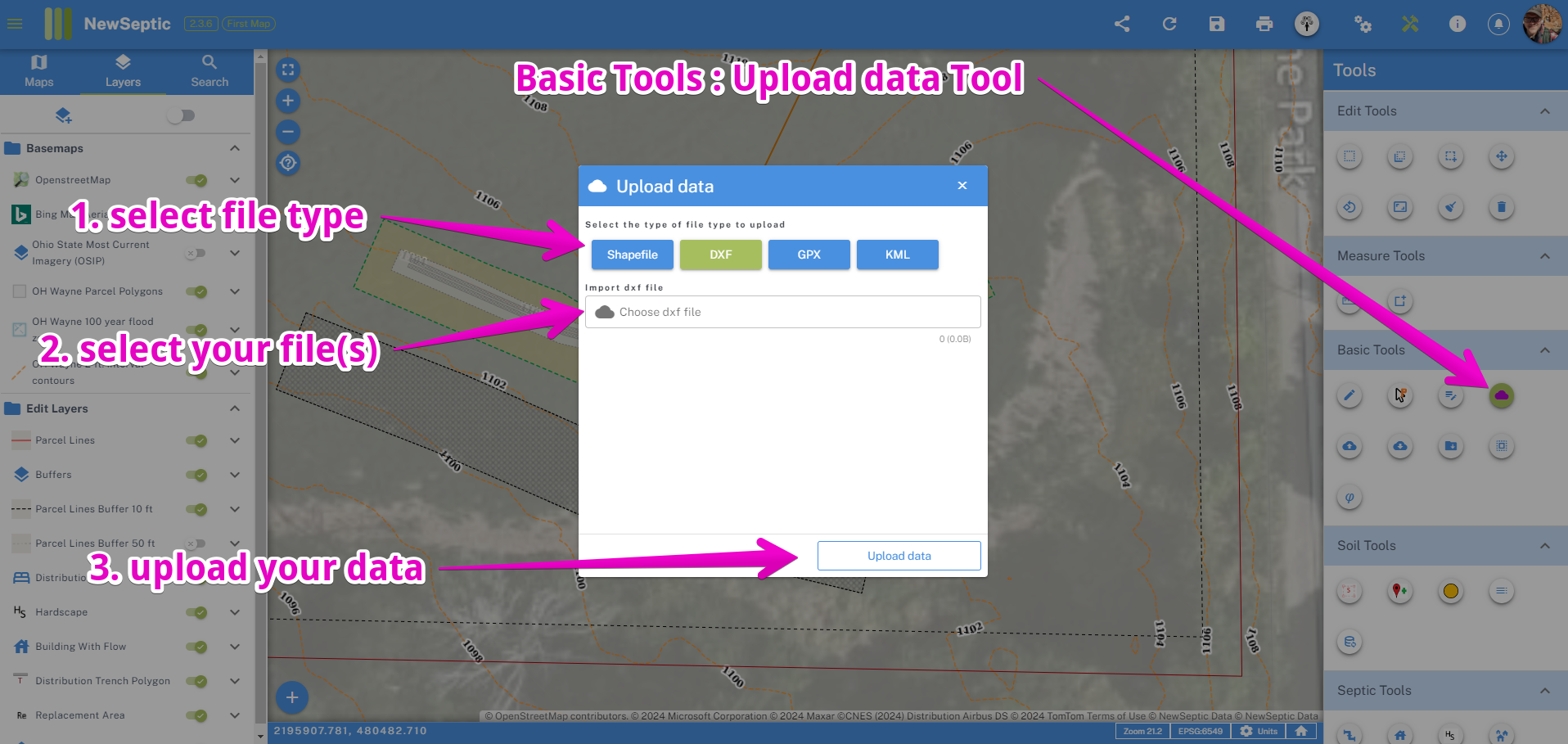
Importing Geographic Files
It is often helpful when designing onsite wastewater treatment systems or other land planning projects to have the ability to collaborate with engineers or surveyors, or simply to import additional data from an outside party.
- In the Basic Toolset, find the Upload data tool
- Select your file type
- Select your files from your local storage
- Upload your data

When your data is uploaded and processed, it will appear in the bell icon on the top right of the application.