Importing GPS Coordinates
Accurate GPS data is highly important component of creating accurate maps.
landplan makes bringing in GPS points into your map simple. To get started, you will need a CSV (comma separated value) file of GPS coordinates following this layout:
Name Latitude or Northing Longitude or Easting Elevation
If you have never worked with CSV files, these files are text files with the file suffix .csv and have rows of data, with each row having columns of data separated by comma.
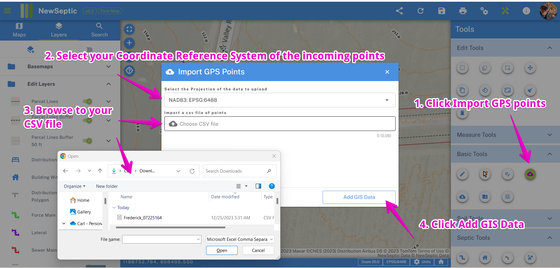
Once you have a CSV file, you can navigate to your project, and follow the steps below:
- In the Basic Toolset, find the Import GPS points tool and click it
- Select the "Coordinate Reference System" (CRS) of the points you are importing. landplan typically only offers 2 CRS types, World projection or State Plane If you have latitude and longitude coordinates, then you CRS is WGS84 or a World CRS.
- Browse to the location of the CSV file on your computer
- Click the Add GIS Data button