Drawing Project Parcel and Setting a New Project Parcel
When you need to change a parcel, there are a few ways built into landplan to do so.
Here are some common workflows:
Viewing Parcel Data and any External Resources
landplan catalogs public county and state GIS resources on our server for your convenience. We store the data in its original format and provide quick references to other valuable information resources by the state or county.
To view the data and any external information resource links:
a. You can click the Select Tool in the Edit Toolset
b. Select the Parcel by clicking on the Parcel Polygon
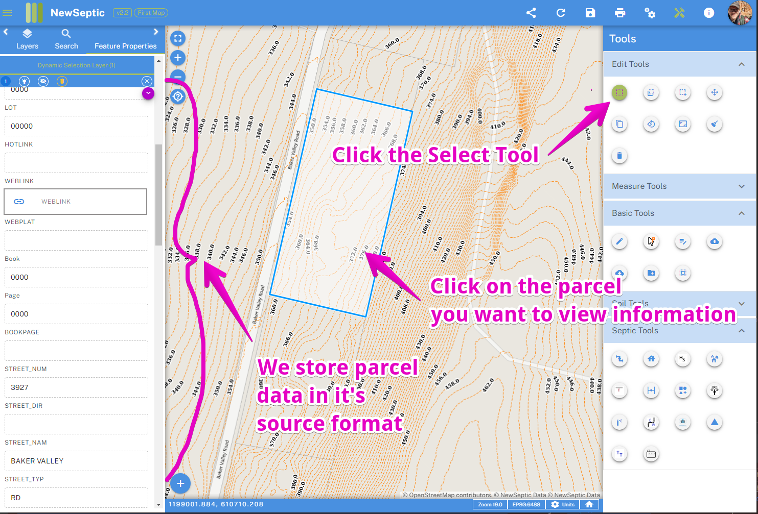
c. Scroll through the data on the left feature properties window
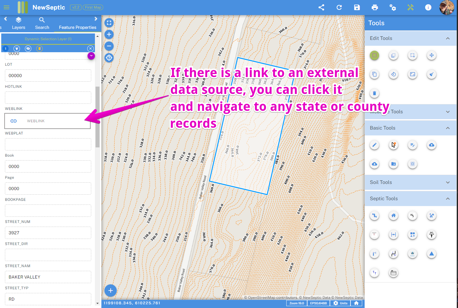
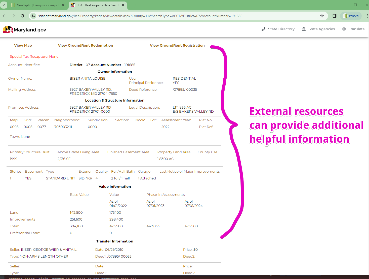
d. Any external resources will be shown with a Paperclip icon and when clicked on will open a tab with the external resources. If a link is broken, kindly let us know and we will be repair it very easily.
Change Project Parcels to Another Existing Parcel
To do so, follow the steps below:
a. You can then right-click on your mouse and select Commit Parcel 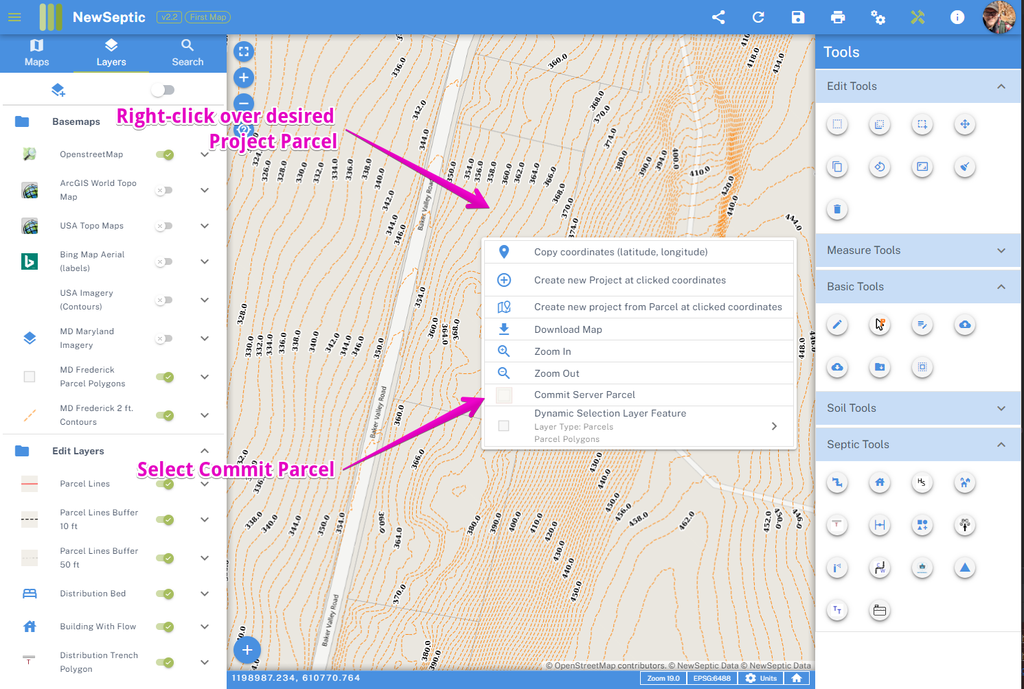 b. You choose whether to remove old project parcel(s)
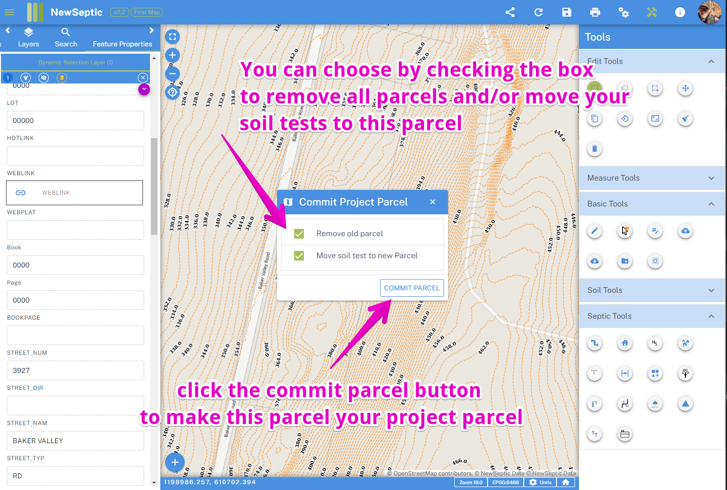
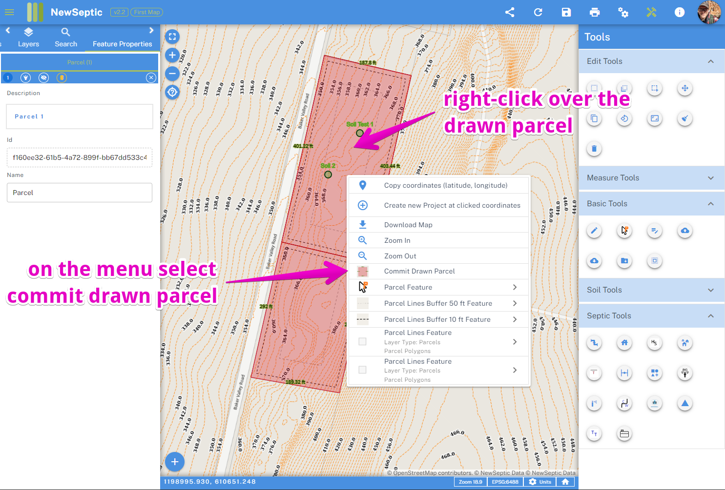
Draw a Parcel from Scratch
To do so, follow the steps below:
a. Click the Parcel Draw tool in the Basic toolset
b. Choose where you want the parcel to start. It helps to import GPS coordinates from a surveyor's or your own field measurements
c. Start clicking to add vertices to your parcel shape. You can delete points by clicking the delete key on your keyboard or on the delete button on the edit tools to remove the last point.
d. When finished double-click to close the polygon.
e. You can then right-click on your mouse and select Commit Parcel
Combine Two or More Existing Parcels
To do so, follow the steps below:
a. Right-click over any parcel you need to combine, and select Commit Parcel
b. Click the Parcel Draw tool in the Basic toolset
c. Open the Snap Options, and make sure Parcel Lines are selected and click Save Options 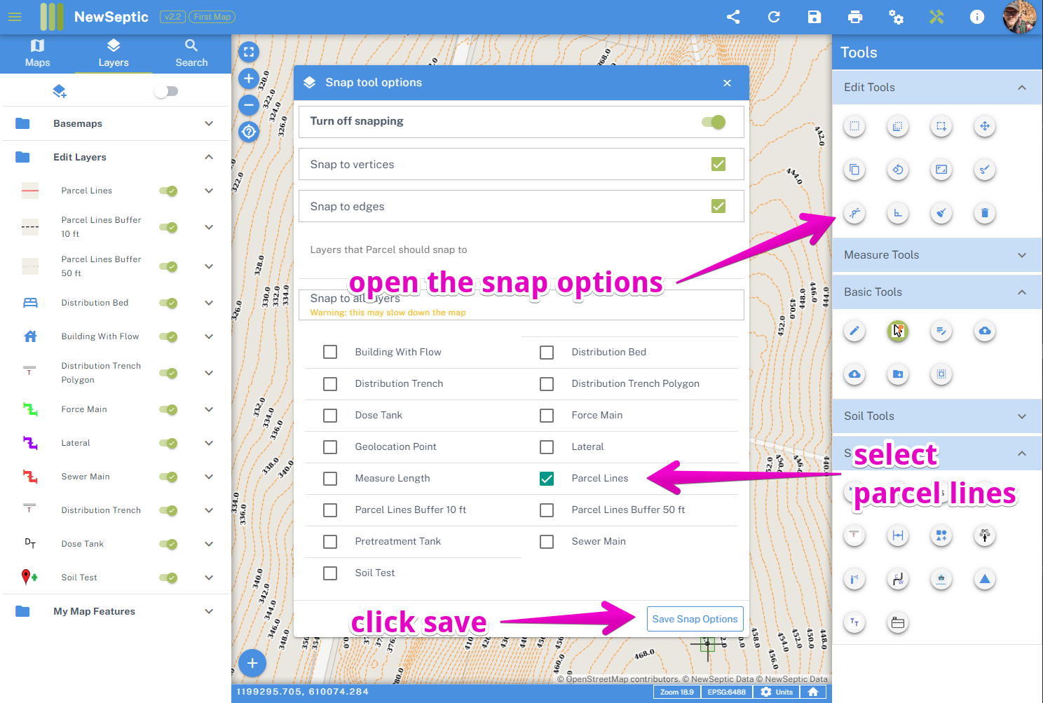 d. Start tracing the existing parcels with the desired outside new parcel lines by clicking on vertices of the existing parcel lines
 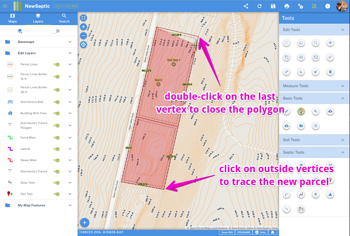 e. When finished double-click to close the polygon
f. You can then right-click on your mouse and select Commit Parcel